


Dana Point
Surf, kitesurf, windsurf and mountain biking town · United States
Surf, kitesurf, windsurf and mountain biking, 6 nights from tomorrow, from your nearest start point: scored, planned and costed. Try another search
Beds: 22 places
22 places to stay within 2 km, 2 of them campsites.
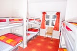 Budget 2-star · Booking.com£85 a night
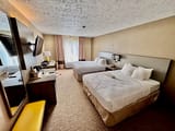 Mid-range 3-star · Booking.com£100 a night
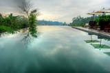 Luxury 4-star · Booking.com£130 a night
Prices are our estimate of the country's average double room of each kind that month: not this town's price, and not a quote.
Room photos are examples, not these hotels (credits).
All 22 places to stay · Booking.comSpots near here: 74 places in 4 sports
Surf · this week
Bamboo Trees · about 1h 25m by car · stays in Carlsbad
56 out of 100Cassidy · about 1h 20m by car · stays in Carlsbad
56 out of 100Churches Point · about 25 min by car · stays in San Clemente
56 out of 100Cottons · about 25 min by car · stays in San Clemente
56 out of 100Dutches A-Frame · about 1h 20m by car · stays in Carlsbad
56 out of 100South Side · about 1h 30m by car · stays in Carlsbad
56 out of 100Tamarack st. · about 1h 25m by car · stays in Carlsbad
56 out of 100Trestles · about 25 min by car · stays in San Clemente
56 out of 100
All 71 surf spots
Upper Trestles · about 25 min by car · stays in San Clemente
56 out of 100Warm Water Jetties · about 1h 30m by car · stays in Carlsbad
56 out of 100Camp Pendelton · about 1h 10m by car · stays in Oceanside
55 out of 100Del Mar Jetties · about 1h 10m by car · stays in Oceanside
55 out of 100Oceanside Pier · about 1h 15m by car · stays in Oceanside
54 out of 100Tyson Street · about 1h 15m by car · stays in Oceanside
54 out of 100Doheny · about 5 min by car
53 out of 100San Onofre · about 30 min by car · stays in San Clemente
53 out of 100Trails - San Onofre State Beach · about 40 min by car · stays in San Onofre
53 out of 10010th street - 1000 step · about 10 min by car · stays in Laguna Beach
52 out of 100Church (Trestles) · about 30 min by car · stays in San Clemente
52 out of 100Cliff st. · about 25 min by car · stays in Laguna Beach
52 out of 100Crescent bay · about 25 min by car · stays in Laguna Beach
52 out of 100El Morro Cove · about 30 min by car · stays in Laguna Beach
52 out of 100Linda Lane Beach · about 15 min by car · stays in San Clemente
52 out of 100Rockpiles · about 25 min by car · stays in Laguna Beach
52 out of 100Salt Creek Heroins · about 10 min by car
52 out of 100Sleepy Hollow · about 20 min by car · stays in Laguna Beach
52 out of 100Strands · about 5 min by car
52 out of 100Thousand steps · about 10 min by car · stays in Laguna Beach
52 out of 100Three Arch Bay · about 10 min by car · stays in Laguna Beach
52 out of 100204.0 · about 15 min by car · stays in San Clemente
51 out of 100Agate st. · about 20 min by car · stays in Laguna Beach
51 out of 100Aliso Creek Beach · about 15 min by car · stays in Laguna Beach
51 out of 100Brooks Street · about 20 min by car · stays in Laguna Beach
51 out of 100Calafia · about 20 min by car · stays in San Clemente
51 out of 100Dana Point · about 5 min by car
51 out of 100Lost Winds · about 20 min by car · stays in San Clemente
51 out of 100Oak street · about 20 min by car · stays in Laguna Beach
51 out of 100Riviera · about 20 min by car · stays in San Clemente
51 out of 100Salt Creek : Gravels · about 5 min by car
51 out of 100Salt Creek Point · about 5 min by car
51 out of 100Salt Creek- Middles · about 5 min by car
51 out of 100San Clemente Pier · about 15 min by car · stays in San Clemente
51 out of 100Seal Beach · about 1h 25m by car · stays in Seal Beach
51 out of 100Seal Beach South Side · about 1h 25m by car · stays in Seal Beach
51 out of 100State park · about 20 min by car · stays in San Clemente
51 out of 100T Street · about 20 min by car · stays in San Clemente
51 out of 100Thaila Street · about 20 min by car · stays in Laguna Beach
51 out of 100Anderson Street · about 1h 20m by car · stays in Seal Beach
50 out of 100Anderson Street - Surfside Bowl · about 1h 20m by car · stays in Seal Beach
50 out of 100Anderson street - The Hole · about 1h 20m by car · stays in Seal Beach
50 out of 100Blackies · about 50 min by car · stays in Newport Beach
50 out of 100Bolsa Chica · about 1h 15m by car · stays in Huntington Beach
50 out of 100Middles · about 45 min by car · stays in Newport Beach
50 out of 100Newport - 15th Street · about 45 min by car · stays in Newport Beach
50 out of 100Oceanside Harbor · about 1h 15m by car · stays in Oceanside
50 out of 100Sunset Beach usa north OC · about 1h 20m by car · stays in Huntington Beach
50 out of 100Rocky Point · about 30 min by car · stays in Laguna Beach
49 out of 100Scotchmans Cove · about 30 min by car · stays in Laguna Beach
49 out of 100Corona del mar · about 40 min by car · stays in Corona Del Mar
48 out of 100Magnolia Street · about 1h 10m by car · stays in Huntington Beach
48 out of 100Crystal Cove · about 35 min by car · stays in Newport Beach
47 out of 100Cylinders · about 40 min by car · stays in Newport Beach
47 out of 100The Wedge · about 40 min by car · stays in Newport Beach
47 out of 10017th Street · about 1h 05m by car · stays in Huntington Beach
46 out of 10036th street · about 50 min by car · stays in Newport Beach
46 out of 10040th Street · about 50 min by car · stays in Newport Beach
46 out of 10056th St. · about 50 min by car · stays in Newport Beach
46 out of 100Newport Beach River Jetties · about 50 min by car · stays in Newport Beach
46 out of 100Huntington Beach · about 1h 05m by car · stays in Huntington Beach
44 out of 100Ray Bay · about 1h 30m by car · stays in Long Beach
40 out of 100Seal Beach Pier Northside · about 1h 25m by car · stays in Seal Beach
40 out of 100
Kitesurf · this week
Dana Point · 0.4 km · stays here
0 out of 100
Windsurf · this week
Dana Point · 0.4 km · stays here
0 out of 100
Mountain biking · this week
Ladera Ranch Trails · 12.5 km · stays here
87 out of 100
Each score is the next week's out of 100, the mean of its best days, as on its own page. Green clears the bar. Distances are from the middle of Dana Point.
Places to eat
6 near Dana Point
Places to eat near Dana Point
- Cali CostaMexican · 0.1 km from the centre
- Hennessey's TavernBar and grill · 0.1 km from the centre
- Peking Dragon RestaurantChinese · 0.1 km from the centre
- Stuft PizzaPizza · 0.1 km from the centre
- The Little Kitchen Asian CafeAsian fusion · 0.1 km from the centre
- Bonjour Café & BistroFrench · 0.2 km from the centre
Within 2 km of the town centre, listed by how complete the listing is (website, opening hours, cuisine) and whether two sources name it. Not a judgement of the food: we have no reviews. Listings © OpenStreetMap contributors (ODbL) and Overture Maps Foundation. Credits
Map
the town and every place near it
Each place is ringed by its best day this week, a surf spot for intermediates: green good, amber fair, pale red poor, as the key says. The dashed circle is 50 km from Dana Point.
The map needs JavaScript. Every place on it is listed on this page, and each place's page links to Google Maps.
One finger scrolls the page; two fingers move the map. Pins are our own positions. Map OpenFreeMap, © OpenMapTiles, data © OpenStreetMap contributors.
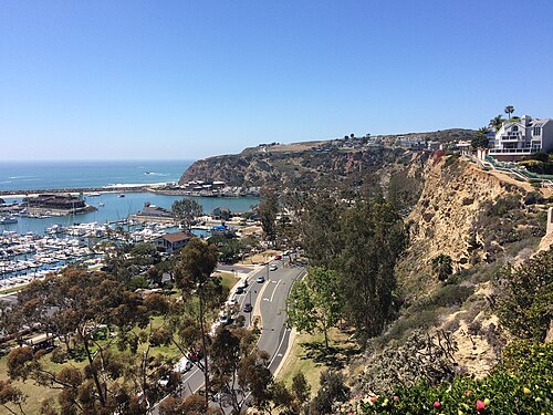
Photos of Dana Point

About Dana Point
where it is, what is near
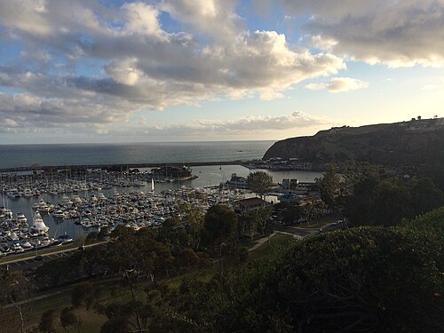
Dana Point is a town in California, United States.
From Dana Point you can reach 71 surf spots, 1 kitesurf spot, 1 windsurf spot and 1 mountain bike area.
The nearest is Dana Point, a kitesurf and windsurf spot 0.4 km from the centre.
Overture lists 22 places to stay within 2 km of the centre, 2 of them campsites.
The nearest airport is John Wayne Orange County International Airport (SNA), 28 km away.
In California · West · United States
- 22 places to stay within 2 km of the centre, 2 of them campsites (Overture places)
- Nearest airports: John Wayne Orange County International Airport (SNA), 28 km, McClellan-Palomar Airport (CLD), 54 km, Long Beach International Airport (LGB), 57 km
Forecast updated . Forecast data: ECMWF, DWD, Météo-France and NOAA, served by Open-Meteo.com (CC BY 4.0). Changed by us. Generated using E.U. Copernicus Marine Service Information.
Scores are the conditions only: the journey, the price and the partners never change them (how we score, how we earn).