

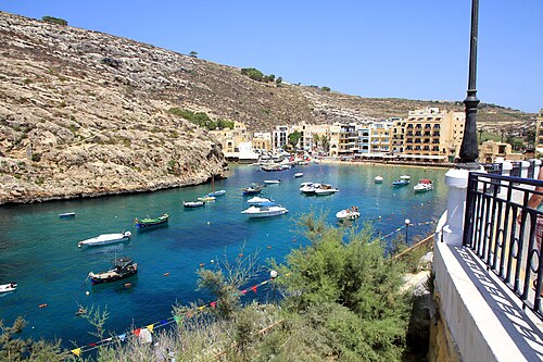

Tower wreck
Dive site · Malta
Experienced divers only
Is it worth the trip?
87Good out of 100 for your dates
Best on Fri 6: Sea: flat, Visibility over 30 m, Water 22 °C
Tue 3 · 80 out of 100
- Sea
- 1.0 m
- Wind
- 18 kn
- Gusts
- 24kn
- Air
- 20°C
Wed 4 · 70 out of 100
- Sea
- 0.3 m
- Wind
- 3 kn
- Gusts
- 6kn
- Air
- 20°C
Thu 5 · 89 out of 100
- Sea
- 0.2 mflat
- Wind
- 7 kn
- Gusts
- 11kn
- Air
- 20°C
Fri 6 · 90 out of 100
- Sea
- 0.2 mflat
- Wind
- 6 kn
- Gusts
- 10kn
- Air
- 19°C
Sat 7 · 89 out of 100
- Sea
- 0.2 mflat
- Wind
- 6 kn
- Gusts
- 9kn
- Air
- 20°C
Sun 8 · 89 out of 100
- Sea
- 0.2 mflat
- Wind
- 4 kn
- Gusts
- 13kn
- Air
- 19°C
Mon 9 · 89 out of 100
- Sea
- 0.2 mflat
- Wind
- 6 kn
- Gusts
- 12kn
- Air
- 21°C
Tap a day for sea, wind and water. Full forecast
Forecast: next 10 days
Full forecast- Mon 226, poor
- Tue 380, good
- Wed 470, good
- Thu 589, good
- Fri 690, good
- Sat 789, good
- Sun 889, good
- Mon 989, good
- Tue 1090, good
- Wed 1188, good
The site in five facts
- Down to 105 mits deepest
- From a boathow you get in
- Experienced / deepexperienced divers only
- Water 22 °C5 mm wetsuit
- Faces SWswell from there reaches it
Full forecast
every day, every number
The score doesn't know currents, the visibility on the day or your certification.
Suits experienced divers only, as a dive guide states it. Scored for experienced divers.
| Day | Score | Sea | Wind | Gusts | Air |
|---|---|---|---|---|---|
| Mon 2Nov | 26, poor | 1.2 m | 26 kn | 36knboats in | 20°C |
| Tue 3Nov | 80, good | 1.0 m | 18 kn | 24kn | 20°C |
| Wed 4Nov | 70, good | 0.3 m | 3 kn | 6kn | 20°C |
| Thu 5Nov | 89, good | 0.2 mflat | 7 kn | 11kn | 20°C |
| Fri 6Nov | 90, good | 0.2 mflat | 6 kn | 10kn | 19°C |
| Sat 7Nov | 89, good | 0.2 mflat | 6 kn | 9kn | 20°C |
| Sun 8Nov | 89, good | 0.2 mflat | 4 kn | 13kn | 19°C |
| Mon 9Nov | 89, good | 0.2 mflat | 6 kn | 12kn | 21°C |
| Tue 10Nov | 90, good | 0.1 mflat | 7 kn | 10kn | 21°C |
| Wed 11Nov | 88, good | 0.2 mflat | 15 kn | 19kn | 23°C |
Sea is the waves near the site, in metres; wind and gusts in knots. "Boats in": gusts that keep dive boats in. More
Tide
- Mon 2 NovLow 02:49 −0.0 mHigh 10:08 +0.1 mLow 16:38 −0.0 mHigh 22:42 +0.0 m
- Tue 3 NovLow 04:41 −0.0 mHigh 11:25 +0.1 mLow 17:38 −0.0 mHigh 23:44 +0.1 m
- Wed 4 NovLow 05:47 −0.1 mHigh 12:13 +0.1 mLow 18:17 −0.1 m
Local clock times; heights about mean sea level. On open coasts the times are usually within a quarter of an hour; in bays, estuaries and on the Gulf of Mexico they can be an hour or more out. Slack water, the safest time to dive where there is current, is about half an hour either side of each high and low. Tide: EOT20 global ocean tide model, Hart-Davis et al. 2021, DGFI-TUM (doi:10.17882/79489), CC BY 4.0. Times and heights computed by us. A model, not a tide table: check a local table before you go.
Forecast updated . It refreshes every three hours. Forecast data: ECMWF, DWD, Météo-France and NOAA, served by Open-Meteo.com (CC BY 4.0). Changed by us. Generated using E.U. Copernicus Marine Service Information.
Map
the site, its town, photos
Tower wreck on Google Maps · Directions
Each place wears its best day on these dates: green good, amber fair, pale red poor, as the key says.
The map needs JavaScript. Every place on it is listed on this page, and each place's page links to Google Maps.
One finger scrolls the page; two fingers move the map. Pins are our own positions. Map OpenFreeMap, © OpenMapTiles, data © OpenStreetMap contributors.
Photos of Tower wreck
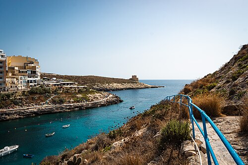

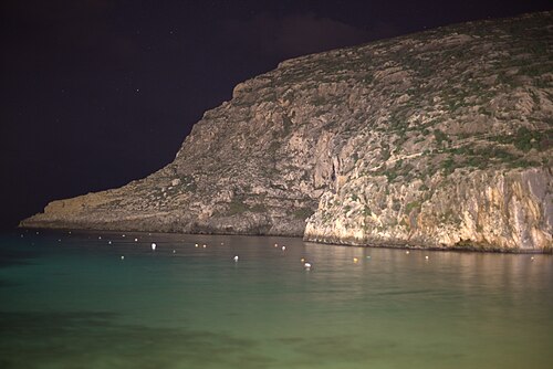

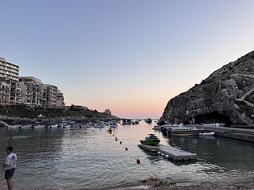

More diving near here
3 places
- Xlendi Tunnel 0.5 km away
- Dawra Tas-Sanap 0.6 km away
- Sanap Cliffs 1 km away
About
the place in full, sources, credits
About Tower wreck
A wreck dive. It goes down to 105 m. You get in from a boat. It suits experienced divers only, as a dive guide states it. The coast faces SW: swell from the SW reaches it, and wind from the NE blows out to sea. 12 dive centres or shops within 10 km, the nearest 0.7 km away. The sea is about 16°C in February, its coldest month (7 mm wetsuit and hood), and 27°C in August, its warmest (3 mm wetsuit). The town to stay in is Munxar. Within 5 km we also list 14 dive sites and 1 climbing area.
- What it is Wreck.
- How deep Down to 105 m: technical diving, past the 40 m recreational limit.
- Getting in From a boat.
- Who it suits Suits experienced divers only, as a dive guide states it.
- Dive centres 12 dive centres or shops within 10 km, the nearest 0.7 km away.
Water about 22°C: 5 mm wetsuit. Typical sea temperature for the time of year, not a forecast.
Visibility over 30 m. Typical for the time of year, estimated from ten years of NASA satellite water clarity, not a forecast. Clearest in Jun, Jul, Aug, Sep, Oct and Nov (over 30 m).
The score is the conditions only: the journey, the price and the partners never change it (how we score, how we earn).
Rough cost (estimate): about US$1,100–US$2,110 each
about US$1,100–US$2,110 each · 6 nights, 2 sharing: flights, taxi, stay, food.
Our estimate from typical public prices, not a quote: check the real prices before you book (where they come from). Prices are about, in US Dollar (USD): our pound figures at the European Central Bank's rate of 2 November 2026.
How we worked it out
| What | How we worked it out | Each |
|---|---|---|
| Flights | return ORD to MLA, estimated from distance and season, changing at MAD, full-service airlines, with a hold bag | about US$557–US$1,150 |
| Taxi | airport and back, shared | about US$74–US$121 |
| Stay | 6 nights, a mid-range double, shared | about US$221–US$369 |
| Food | 7 days eating out | about US$248–US$463 |
| Total | about US$1,100–US$2,110 |
Guided dives are not priced yet: we have no sourced price, so it is not in it. Prices from public sources, checked in 2026.
Where to stay: Munxar
Ad Links marked Ad may pay us if you book. You pay the same, and they never change a score. How we earn
about 5 min by car · 67 places to stay
about US$81/nightcountry average
About Munxar its beds, food and every spot near it
About US$81 a night is our estimate of the country's average 2-star double room that month: not each town's price, and not a quote. Drives are estimates. Prices are about, in US Dollar (USD): our pound figures at the European Central Bank's rate of 2 November 2026.
Getting there: about 19h 15m
About 19h 15m door to door from Chicago
Fly ORD → MLA, changing at Adolfo Suárez Madrid–Barajas Airport (MAD), then 50 min by road
Flights ORD → MLA on your dates · AviasalesAdeSIM for your phone · Search on AiraloAd
An estimate, one way; the journey never changes the score.
In the water
Dives and courses in Munxar · GetYourGuideDive gear hire in Munxar · GetYourGuide
Dive centres nearby
Saint Andrew's Divers Cove 0.7 kmCMASPADI
Utina 0.8 km
Ritual Dive 0.9 km
Dwejra Divers 3.5 km
Family Diving 6.6 km
The nearest named dive centres and shops within 25 km, in a straight line; training agencies where the map states them. Listings, not a recommendation. Dive centres: © OpenStreetMap contributors (ODbL). Credits
What you might see
Too few records at this site itself, so these are the animals divers and surveys have recorded at other sites within 25 km in the last 15 years. A record says someone saw it there, not that you will.
Common octopus Octopus vulgarisOctopus
Seen in 127 records.
Leopard nudibranch Peltodoris atromaculataNudibranch
Seen in 31 records, mostly Apr.
Slit limpets Flabellina affinisNudibranch
Seen in 20 records, mostly Apr.
Painted comber Serranus scriba
Seen in 1182 records, mostly Jul to Sep.
Mediterranean rainbow wrasse Coris julis
Seen in 1134 records, mostly Jul to Sep.
European parrotfish Sparisoma cretense
Seen in 1019 records, mostly Jul to Sep.
Ornate wrasse Thalassoma pavo
Seen in 866 records, mostly Jul to Sep.
Salema porgy Sarpa salpa
Seen in 487 records, mostly Jul to Sep.
Comber Serranus cabrilla
Seen in 365 records, mostly Jul to Sep.
Dusky perch Epinephelus marginatus
Seen in 323 records, mostly Jul to Sep.
Chromis chromisDamselfishes
Seen in 218 records, mostly Jun to Oct.
Apogon imberbisCardinalfish
Seen in 200 records, mostly Jul to Oct.
Records: OBIS (Ocean Biodiversity Information System, IOC-UNESCO) and GBIF.org (1 November 2026, doi:10.15468/dl.jeesns), from the datasets named here, CC0 and CC BY records only. Names: WoRMS and GBIF; common names from the Catalogue of Life, the GBIF Backbone and Wikidata. Largest datasets here: ClimateFish: A database to track the abundance of selected coastal fish species as candidate indicators of climate change; Programme BioObs: observations naturalistes en milieux aquatiques-Observations de BioObs.; Programme CROMIS: carnet de plongée en ligne de la FFESSM-Observations d'espèces subaquatiques collectées par les utilisateurs de CROMIS; iNaturalist Research-grade Observations; Reef Check Med - key Mediterranean marine species 2001-2020. Credits
This week's visibility and the current no free forecast gives. Ask a dive centre before you book.
Saved: this link opens the same trip
The link holds the trip itself: nothing about you is kept. Check the forecast again before you book.