

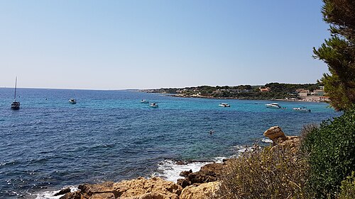

Le Dalton
Dive site · France
Advanced divers and up
Is it worth the trip?
67Good out of 100 for your dates
2 days tie for best
Mon 2 · 71 out of 100
- Sea
- 0.3 m
- Wind
- 11 kn
- Gusts
- 18kn
- Air
- 15°C
Tue 3 · 76 out of 100
- Sea
- 0.1 mflat
- Wind
- 1 kn
- Gusts
- 5kn
- Air
- 16°C
Wed 4 · 28 out of 100
- Sea
- 1.2 m
- Wind
- 23 kn
- Gusts
- 30knboats in
- Air
- 16°C
Thu 5 · 30 out of 100
- Sea
- 1.2 m
- Wind
- 23 kn
- Gusts
- 30knboats in
- Air
- 17°C
Fri 6 · 72 out of 100
- Sea
- 0.4 m
- Wind
- 8 kn
- Gusts
- 17kn
- Air
- 16°C
Sat 7 · 67 out of 100
- Sea
- 0.1 mflat
- Wind
- 6 kn
- Gusts
- 11kn
- Air
- 15°C
Sun 8 · 76 out of 100
- Sea
- 0.1 mflat
- Wind
- 5 kn
- Gusts
- 9kn
- Air
- 17°C
Tap a day for sea, wind and water. Full forecast
Forecast: next 10 days
Full forecast- Mon 271, good
- Tue 376, good
- Wed 428, poor
- Thu 530, poor
- Fri 672, good
- Sat 767, good
- Sun 876, good
- Mon 966, good
- Tue 1013, poor
- Wed 1113, poor
The site in four facts
- Down to 45 mits deepest
- Advancedand up
- Water 17 °C7 mm wetsuit and hood
- Faces SWswell from there reaches it
Full forecast
every day, every number
The score doesn't know currents, the visibility on the day or your certification.
Suits Advanced divers and up, as a dive guide states it. Scored for Advanced divers.
| Day | Score | Sea | Wind | Gusts | Air |
|---|---|---|---|---|---|
| Mon 2Nov | 71, good | 0.3 m | 11 kn | 18kn | 15°C |
| Tue 3Nov | 76, good | 0.1 mflat | 1 kn | 5kn | 16°C |
| Wed 4Nov | 28, poor | 1.2 m | 23 kn | 30knboats in | 16°C |
| Thu 5Nov | 30, poor | 1.2 m | 23 kn | 30knboats in | 17°C |
| Fri 6Nov | 72, good | 0.4 m | 8 kn | 17kn | 16°C |
| Sat 7Nov | 67, good | 0.1 mflat | 6 kn | 11kn | 15°C |
| Sun 8Nov | 76, good | 0.1 mflat | 5 kn | 9kn | 17°C |
| Mon 9Nov | 66, good | 0.3 m | 17 kn | 23kn | 18°C |
| Tue 10Nov | 13, poor | 0.7 m | 23 kn | 30knboats in | 18°C |
| Wed 11Nov | 13, poor | 1.2 m | 25 kn | 37knboats in | 17°C |
Sea is the waves near the site, in metres; wind and gusts in knots. "Boats in": gusts that keep dive boats in. More
Tide
- Mon 2 NovHigh 00:49 −0.0 mLow 07:20 −0.1 mHigh 14:54 +0.1 mLow 22:48 −0.1 m
- Tue 3 NovHigh 03:35 −0.0 mLow 09:07 −0.1 mHigh 16:03 +0.1 mLow 23:28 −0.1 m
- Wed 4 NovHigh 05:16 −0.0 mLow 10:23 −0.1 mHigh 16:54 +0.1 m
Local clock times; heights about mean sea level. On open coasts the times are usually within a quarter of an hour; in bays, estuaries and on the Gulf of Mexico they can be an hour or more out. Slack water, the safest time to dive where there is current, is about half an hour either side of each high and low. Tide: EOT20 global ocean tide model, Hart-Davis et al. 2021, DGFI-TUM (doi:10.17882/79489), CC BY 4.0. Times and heights computed by us. A model, not a tide table: check a local table before you go.
Forecast updated . It refreshes every three hours. Forecast data: ECMWF, DWD, Météo-France and NOAA, served by Open-Meteo.com (CC BY 4.0). Changed by us. Generated using E.U. Copernicus Marine Service Information.
Best time to go
No month stands out
Good diving days in a typical week, each month, for Advanced divers, from 2016 on (ERA5 history scored the same way).
- Jan6of 7: a trip from Sat 2 Jan
- Feb6of 7: a trip from Sat 6 Feb
- Mar7of 7: a trip from Sat 6 Mar
- Apr7of 7: a trip from Sat 3 Apr
- May7of 7: a trip from Sat 1 May
- Jun7of 7: a trip from Sat 5 Jun
- Jul7of 7: a trip from Sat 3 Jul
- Aug7of 7: a trip from Sat 7 Aug
- Sep7of 7: a trip from Sat 4 Sept
- Oct7of 7: a trip from Sat 2 Oct
- Nov7of 7: a trip from Tue 3 Nov
- Dec6of 7: a trip from Sat 5 Dec
Tap a month to see this spot for a trip then.
Typical, not a forecast: the sea and the mean wind of each day, with no gusts or rain in the history.
Map
the site and its town
Le Dalton on Google Maps · Directions
Each place wears its best day on these dates: green good, amber fair, pale red poor, as the key says.
The map needs JavaScript. Every place on it is listed on this page, and each place's page links to Google Maps.
One finger scrolls the page; two fingers move the map. Pins are our own positions. Map OpenFreeMap, © OpenMapTiles, data © OpenStreetMap contributors.
More diving near here
3 places
- Messerschmit 0.1 km away
- Le Chaouen 0.2 km away
- Arche du plannier 0.6 km away
About
the place in full, sources, credits
About Le Dalton
A wreck dive. It goes down to 45 m. It suits Advanced divers and up, as a dive guide states it. The coast faces SW: swell from the SW reaches it, and wind from the NE blows out to sea. 2 dive centres or shops within 10 km, the nearest 8.8 km away. The sea is about 13°C in February, its coldest month (7 mm semi-dry or a drysuit), and 23°C in August, its warmest (5 mm wetsuit). The town to stay in is Carry-le-Rouet. Within 5 km we also list 4 dive sites.
- What it is Wreck.
- How deep Down to 45 m: technical diving, past the 40 m recreational limit.
- Who it suits Suits Advanced divers and up, as a dive guide states it.
- Dive centres 2 dive centres or shops within 10 km, the nearest 8.8 km away.
Water about 17°C: 7 mm wetsuit and hood. Typical sea temperature for the time of year, not a forecast.
Visibility about 15 m. Typical for the time of year, estimated from ten years of NASA satellite water clarity, not a forecast. Clearest in Jun, Jul, Aug and Sep (about 20 m).
The score is the conditions only: the journey, the price and the partners never change it (how we score, how we earn).
Rough cost (estimate): about US$1,150–US$2,180 each
about US$1,150–US$2,180 each · 6 nights, 2 sharing: flights, taxi, stay, food.
Our estimate from typical public prices, not a quote: check the real prices before you book (where they come from). Prices are about, in US Dollar (USD): our pound figures at the European Central Bank's rate of 2 November 2026.
How we worked it out
| What | How we worked it out | Each |
|---|---|---|
| Flights | return ORD to MRS, estimated from distance and season, changing at CDG, full-service airlines, with a hold bag | about US$497–US$1,030 |
| Taxi | airport and back, shared | about US$60–US$101 |
| Stay | 6 nights, a mid-range double, shared | about US$282–US$470 |
| Food | 7 days eating out | about US$315–US$584 |
| Total | about US$1,150–US$2,180 |
Guided dives are not priced yet: we have no sourced price, so it is not in it. Prices from public sources, checked in 2026.
Where to stay: Carry-le-Rouet
Ad Links marked Ad may pay us if you book. You pay the same, and they never change a score. How we earn
54 min by car · 16 places to stay
about US$107/nightcountry average
About Carry-le-Rouet its beds, food and every spot near it
About US$107 a night is our estimate of the country's average 2-star double room that month: not each town's price, and not a quote. Drives are estimates. Prices are about, in US Dollar (USD): our pound figures at the European Central Bank's rate of 2 November 2026.
Getting there: about 17h 45m
About 17h 45m door to door from Chicago
Fly ORD → MRS, changing at Charles de Gaulle International Airport (CDG), then 45 min by road
Flights ORD → MRS on your dates · AviasalesAdeSIM for your phone · Search on AiraloAd
An estimate, one way; the journey never changes the score.
In the water
Dives and courses in Carry-le-Rouet · GetYourGuideDive gear hire in Carry-le-Rouet · GetYourGuide
Dive centres nearby
UCPA Cap Croisette 8.8 km
Centre de Loisirs des Goudes 9.6 km
L'atelier de la mer 12 kmCMASPADI
CIP Marseille 12 kmCMASPADI
L'Enfant et la Mer 12 km
The nearest named dive centres and shops within 25 km, in a straight line; training agencies where the map states them. Listings, not a recommendation. Dive centres: © OpenStreetMap contributors (ODbL). Credits
What you might see
Too few records at this site itself, so these are the animals divers and surveys have recorded at other sites within 25 km in the last 15 years. A record says someone saw it there, not that you will.
Echinocyamus pusillus
Seen in 10 records, mostly Apr.
Ophiura ophiura
Seen in 10 records, mostly Apr.
Ophiura albida
Seen in 8 records.
Amphiura chiajei
Seen in 6 records.
Ebalia deshayesi
Seen in 6 records.
Genocidaris maculata
Seen in 6 records.
Achaeus cranchii
Seen in 4 records.
Circular crab Atelecyclus rotundatus
Seen in 4 records.
Epizoanthus arenaceus
Seen in 4 records.
Leptosynapta inhaerens
Seen in 4 records.
Ophiopsila annulosa
Seen in 4 records.
Parthenopoides massena
Seen in 4 records.
Records: OBIS (Ocean Biodiversity Information System, IOC-UNESCO), from the datasets named here, CC0 and CC BY records only. Names: WoRMS, through OBIS; common names from Wikidata. Largest datasets here: ClimateFish: A database to track the abundance of selected coastal fish species as candidate indicators of climate change; QUADRIGE - Coastal monitoring database and products, 1974 onwards. (6064); QUADRIGE - Coastal monitoring database and products, 1974 onwards. (6064); dbc707d7-7659-46c1-b0c2-8a64f36dfd82; Great Eggcase Hunt - citizen science observations of chondrichthyian eggcases. Credits
This week's visibility and the current no free forecast gives. Ask a dive centre before you book.
Saved: this link opens the same trip
The link holds the trip itself: nothing about you is kept. Check the forecast again before you book.